Shetland Islands 2013
Skeld to Foula - Thursday 20th June
I'd taken a novel based in Shetland called Sacrifice by SJ Bolton. The heroine Tora Hamilton, was a consultant surgeon working in a fictitious Lerwick hospital. I'd been to several of the locations featured in the book, not least the Kergord Valley along which Tora escaped on a horse. I finished the book and left it for Karen and the Böd's library.
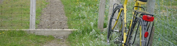
After breakfast of crunchy nut corn flakes, tea and chocolate, I filled the flask, packed the bags and loaded the bike before pushing it outside. |
 |
The weather was far better than the last time I'd cycled from Skeld to Walls and I took in far more of the lovely scenery on-route.
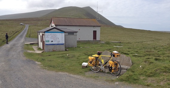
Many ups and downs around Gruting Voe eventually led to Bridge of Walls, the last bit on the same road I'd cycled on Monday. I started north east on the A971 to take a look at the Scord of Brouster which I'd seen two year's previously from a distance.
This time I parked the bike and struck out on foot off up the hill following the interpretation boards. The neolithic farm site was quite extensive with three houses, fields and a cairn. The site was abandoned due to peat when the climate became wetter around 1500 BC. |
 |
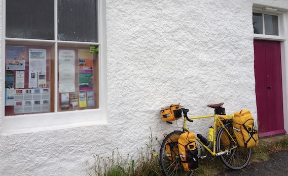
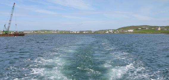
It was really pleasant on the ride round to Walls, breezy but the sea looked a lot less angry. Paying for provisions at the shop revealed a temporary cash crisis, not least for my ferry fare. The nice shop man advised about the whereabouts of the nearest cash machine which appeared to be miles away, however he told me cash was available free from the Post Office. I asked him for directions and he pointed across the shop and met me again from behind its counter.
The motor cyclists from the boat arrived in the shop car park. I phoned the ferry info line and the recorded message gave the good news that the ferry was underway. I cycled the short distance once more to the ferry terminal and mooched around waiting for its arrival.
Two hikers arrived to check the ferry, they'd also been turned away on Tuesday. Sheila and Brian were camping near Lerwick and had driven over to Walls, they planned to camp on Foula in their smaller tent. We discussed walking routes whilst looking at Sheila's OS map of the island folded in a map case, which looked very odd until I spotted that we were actually looking at Fair Isle not Foula, funny really. |
 |
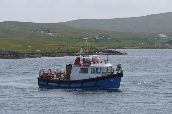
After a short wait spent in pleasant sunshine, the ferry hove into view then turned to manoeuvre into its docking position alongside the pier.
|
 |
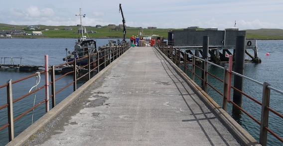 |
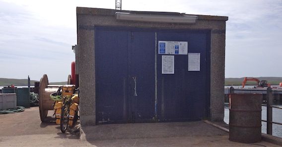
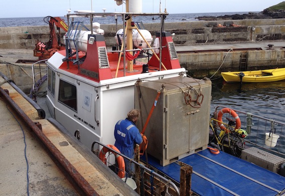
The ferry Master told me that passengers would be allowed to board this time, however he was no longer Master as the main guy was back. The crew began to take stuff out of the store for loading onto the ferry, most of which appeared to be a dismantled flat pack kitchen.
|
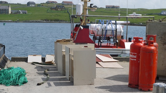 |
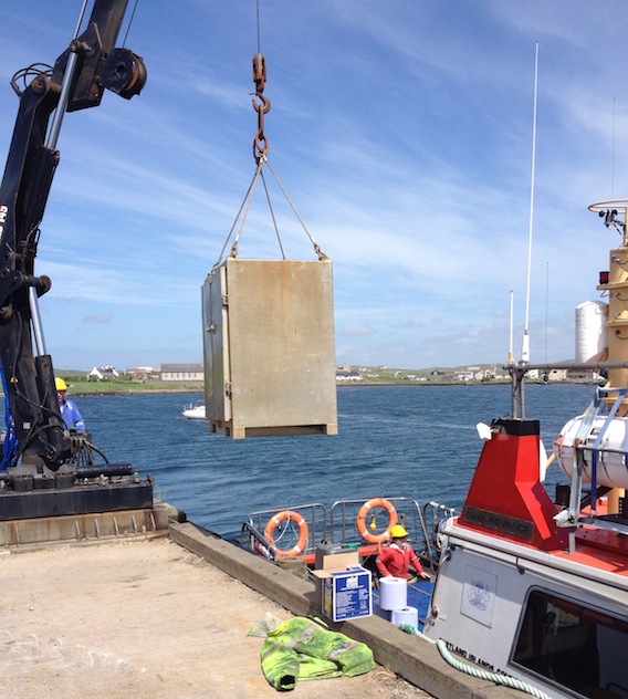
The kitchen wasn't in prime condition to start with and didn't survive completely in tact after being passed down into the hold. Everything else including my panniers and the hikers' rucsacs were loaded into a large metal safe which was itself winched aboard using the pier crane.
|
 |
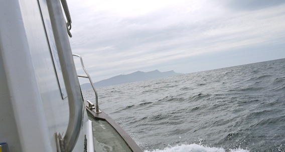
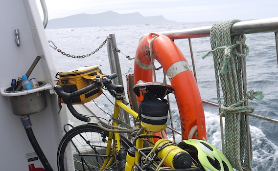
The bike was passed down and tied securely to the side rail. We set sail into Vaila Sound, apparently the first ten minutes or so would be relatively calm until we reached open ocean. The scenery on each side unfolded as we navigated around Vaila and out into the Atlantic for our two and a quarter hour passage.
|
 |
 |
 |
 |
 |
The small crew member was indeed a girl. She spread herself out on a bench seat in the cabin and began knitting, I think she was knitting squares for a charity blanket but it was noisy and I might have misheard her.
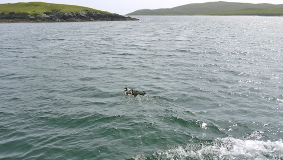
The boat began to rock and roll significantly as we entered the open waters of the Atlantic. The boat was rated for twelve passengers so there was room inside the cabin, however it was more exhilarating to sit on the hold cover at the back and take in the wonderful long distance views, wildlife and sea air. The conditions were as "could be expected for the time of year", I began to wonder what it had truly been like on Tuesday!
I asked a member of the crew about the construction of the new Walls harbour and whether it would benefit the ferry. He commented that they didn't really need it and that other Shetlanders would probably regard it as 'more money being spent on Foula', when it wasn't really. They'd have been happier with a new crane, but the old one is just being relocated.
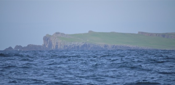
Slowly, Foula began to grow on the horizon. |
 |
 |
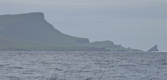 |
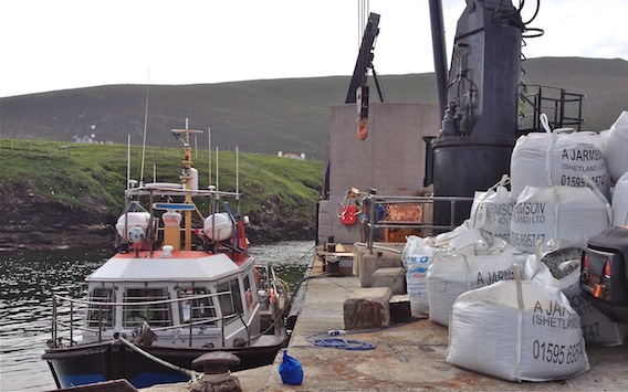
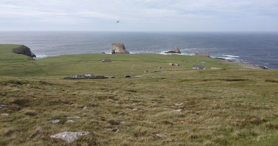
The New Advance navigated around the harbour wall and tied up alongside the crane. We climbed up the ladder onto the dock and waited as the crew started to unload with swift proficiency. The crane was much bigger than the one at Walls and the safe was soon winched ashore. We watched from a safe distance.
|
 |
Sheila pointed to the bike as it floated through the air dangling from the crane's hook.
|
 |
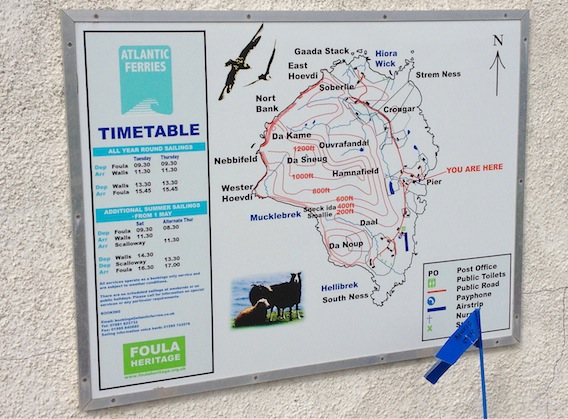
With everything safely ashore and the panniers attached, I wished Sheila and Brian a pleasant stay and cycled off up the road. The ferry terminal had a map and timetable on the wall and in front was a basket full of something called 'bonxie sticks', which could be hired for a pound each.
|
 |
Sheila had asked me about camping spots and I'd told her about an account online, where someone had camped near the airstrip. With this in mind, I decided to head south first, the road on Foula is not that long anyway. From the main place Da Toon o Ham, there's a reasonably severe descent and ascent across the valley that runs down to the harbour, I ended up pushing the bike. The first thing to notice is the number of vehicles parked around in various states of decay. Nearly all the cars had come over on the New Advance amazingly enough, so there's probably no viable reason to send scrap ones back.
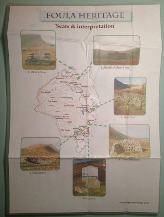
After another gentle climb I reached the turning to the airstrip and noticed two people crouched down in the field in front of the terminal building. They stood up and scuttled away as I approached, which seemed very odd indeed. There was a plastic box by a circular stone bench and inside were laminated A4 sized copies of the Foula map I'd seen earlier. I picked one out and resealed the box. |
 |
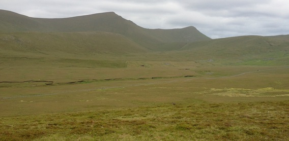
I stopped at Da Niggards to take in the scene to the south of the island and west up Da Daal, startlingly beautiful. The whale back ridge rose up to Hamnafield then on to Da Sneug at 418 metres. Instead of dropping down to Da Hametoon and the inevitable cycle back up, I turned round and coasted back towards the airstrip.
A guy with binoculars was wandering around near the terminal building as I passed by. I propped up the bike against a stone seat and read the details on another map and welcome sign. There were a few parked cars but not much activity apart from some sheep strolling along the airstrip. |
 |
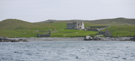
The guy was wearing a RSPB fleece and explained that he and some others were working on a project to investigate the downturn in arctic skua numbers on the island. He was watching a nest where they'd set a trap to catch a pair of birds, and that's what the two figures I'd seen earlier were doing. They needed to check the birds' rings and replace their eggs with fake ones - although I can't remember the exact purpose for this. The RSPB man asked if I was camping, he told me about extensive fields at Garda Stack that might be suitable to pitch a tent.
It seemed like a good opportunity to take a few photographs with the zoom lens so I returned to the bike to get my Lumix camera. To my shock and horror, the blue dry bag was missing from its usual place in the top of the right rear pannier. Visions of all those lost photos flashed by until I tracked back in my mind to the last time I'd used the camera, on the boat. Then I remembered putting the bag down on the dock.
Hastily and in a slight panic, I buckled up the pannier and said good-bye to the RSPB man, he must have thought I was mad. Having made sure I wouldn't disturb the arctic skua catching plan, I sprinted back up the track to the main road and north to the harbour. The dodgy tarmac proved slightly tricky on the valley descent and ascent, however I was soon back at the dock. There, exactly where I'd left it was the blue dry bag containing my Lumix camera and lenses. Phew!
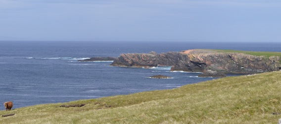
Now I was heading north to cycle the other bit of road. Using the heritage map, I navigated to the right turning which swept round and down to Garda Stack. What a view, I was gobsmacked. The coastal panorama opened up with long views to the horizon and rolling green fields ending in sea stacks sitting in a sparkling sea. |
 |
 |
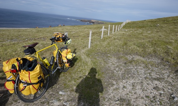 |
I considered several possible sites for the tent. It didn't seem wise to go further down towards the sea after the road ran out, it'd be a long way (and climb) to visit anywhere else. In complete indecision, I started to push the bike back up the hill, with half a thought to go back once again to the airstrip.
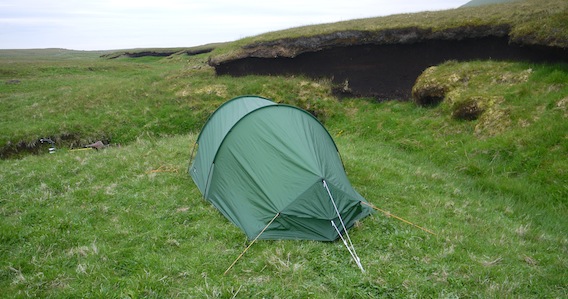
The road back started to follow a shallow valley and off to the right I spotted a level grassy patch on a little flood plain beside the stream. The location also benefitted from a perimeter fence which kept out the sheep, however it also made it necessary to debag the bike to get over. |
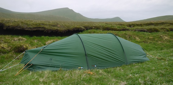 |
At another bend in the stream further down was a slightly better spot and I set up camp in the shelter of a large peat embankment. I realised that it must have been scoured out by the stream in full flood and hoped that my little campsite would remain safe for two nights at least.
|
 |
I even had a wonderful view of Da Sneug and Da Kame.
|
 |
 |
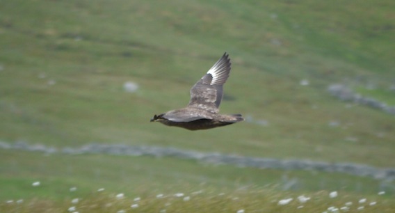
Bonxie's were flying around overhead.
|
 |
I made tea and settled down for the evening as the sun sank into the hills and the midges started to gather in numbers. Strange thing about nightime in Shetland in June, it never really gets dark, only the simmer dim.
Day seven
|